|
|
Routine Scanning
Mission Report: 20130913-1 |
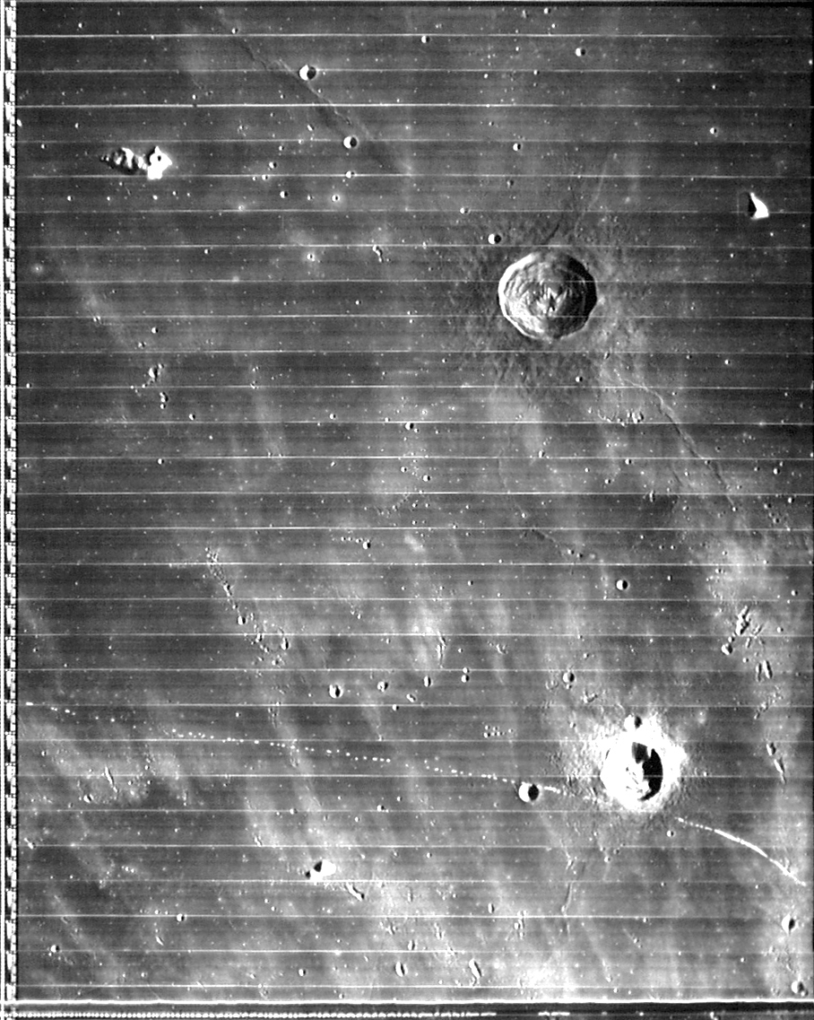
 September 13, 2013 Prior to a qualitative analysis and inventory of
the data from Session 20130913 this image was
randomly selected. It was imaged by Camera 4 which
is the SSI camera and recorded on DVR2. This imame
was selected quickly due to interest stirred by the
live imaging and notes taken concerning a serpentine
ridge on the lunar surface highlighted by the low
sun angle near the terminator. The bright lighted
object to the left of the ridge was almost certainly
a mountain peak catching the rising sun. The dimmer
object to the right of the ridge was either a hill
on the ridge or a crater tilted to the east on the
side of the wrinkle ridge, itself. Keep in mind that
this may not be the best image of these features
taken during this mission, but good enough to begin
some research to identify these mountains.
The first place to check to identify these
mountains was the Rukl Atlas. The area of the image
covers Sections 20,21,42, and 43. However the area
of the brightest target in question is in section
20. (See below). The vertical line on the
right separates 20 and 21.
 Rukl Section 19 (left), 20
(center), 21 (right)
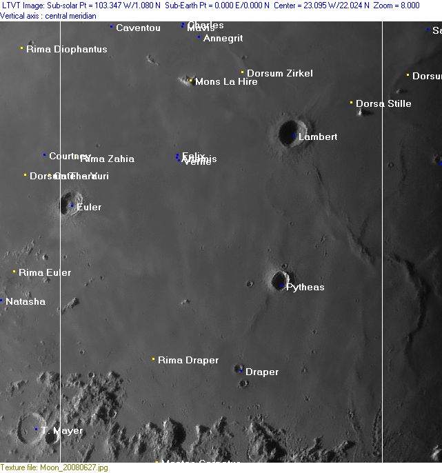
The large crater, Lambert shown in the upper
right above, is unlit in our image at the top of
this report and not observable, but the "mountain"
is clearly shown. Or was it a mountain or a crater?
And what was its name?
The only thing noticeable was the title,Dorsa
Stille, so I looked that up, and here's what I
found:
 The large deeply-shadowed crater on the left
margin is Lambert, which we already knew. But Dorsa
Stille extends at least from "B" to "C" in this
Apollo 15 Metric Camera view, from "A" to "B". It
probably includes the whole "A"-"B" and "C"-"D"
ridges. The thin east-west ridge visible in the
upper right (just below the top margin) is the
western part of Dorsum Higazy, although exactly
where that dorsum name is regarded as ending is also
unclear. On LTO-40B4, the peak in the center of this
view was given the provisional name MONS UNDEST, a
name which was not adopted by the IAU, and is
therefore invalid.
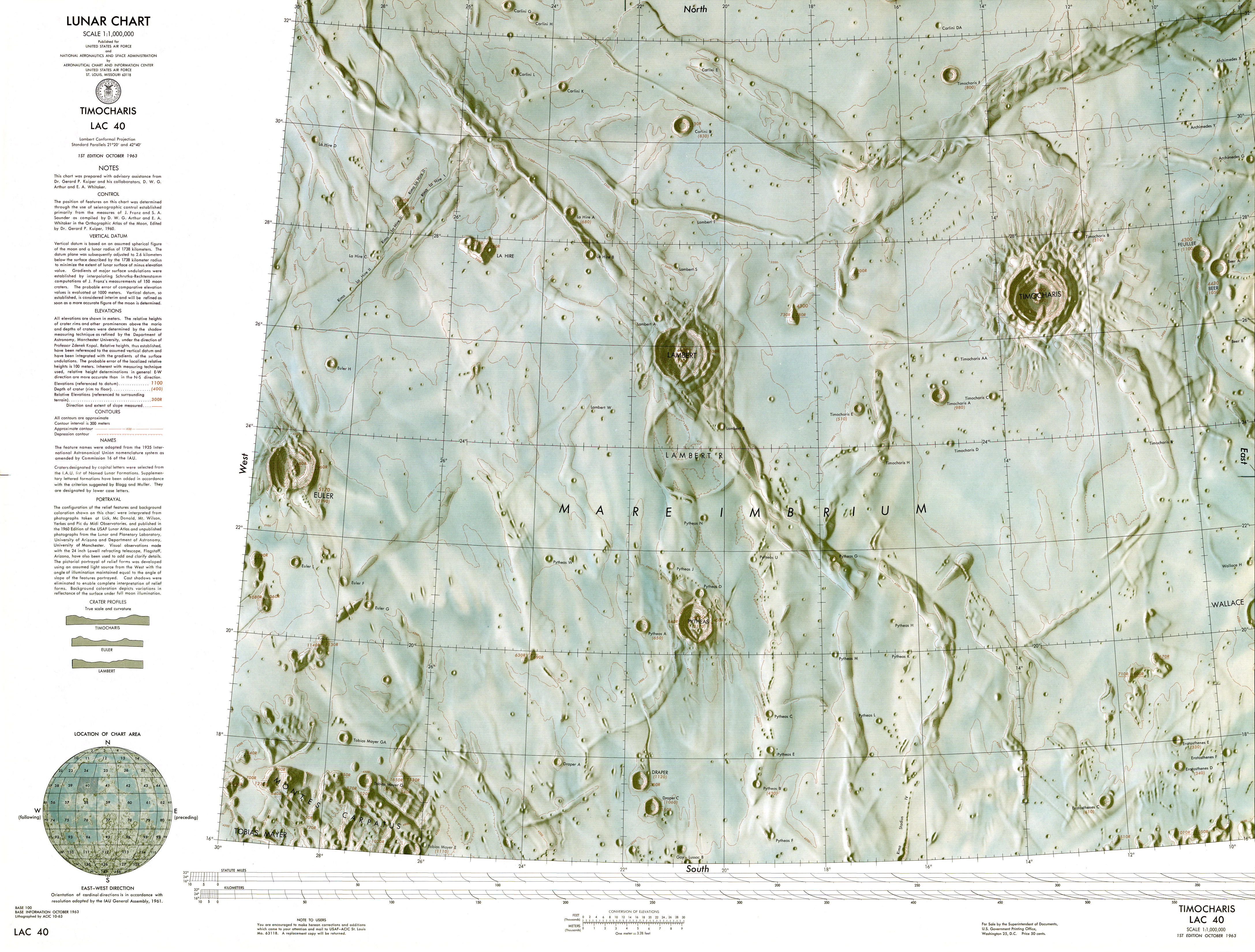 LAC 40 http://www.lpi.usra.edu/resources/mapcatalog/LAC/lac40/150dpi.jpg
Click on the link above, then click on the center to enlarge. So it is a peak and un-named. For all practical
purposes we'll still (no pun intended) refer to this
feature as "Mons Undest" The other dimmer feature
we'll confront next. But before we do let's take a
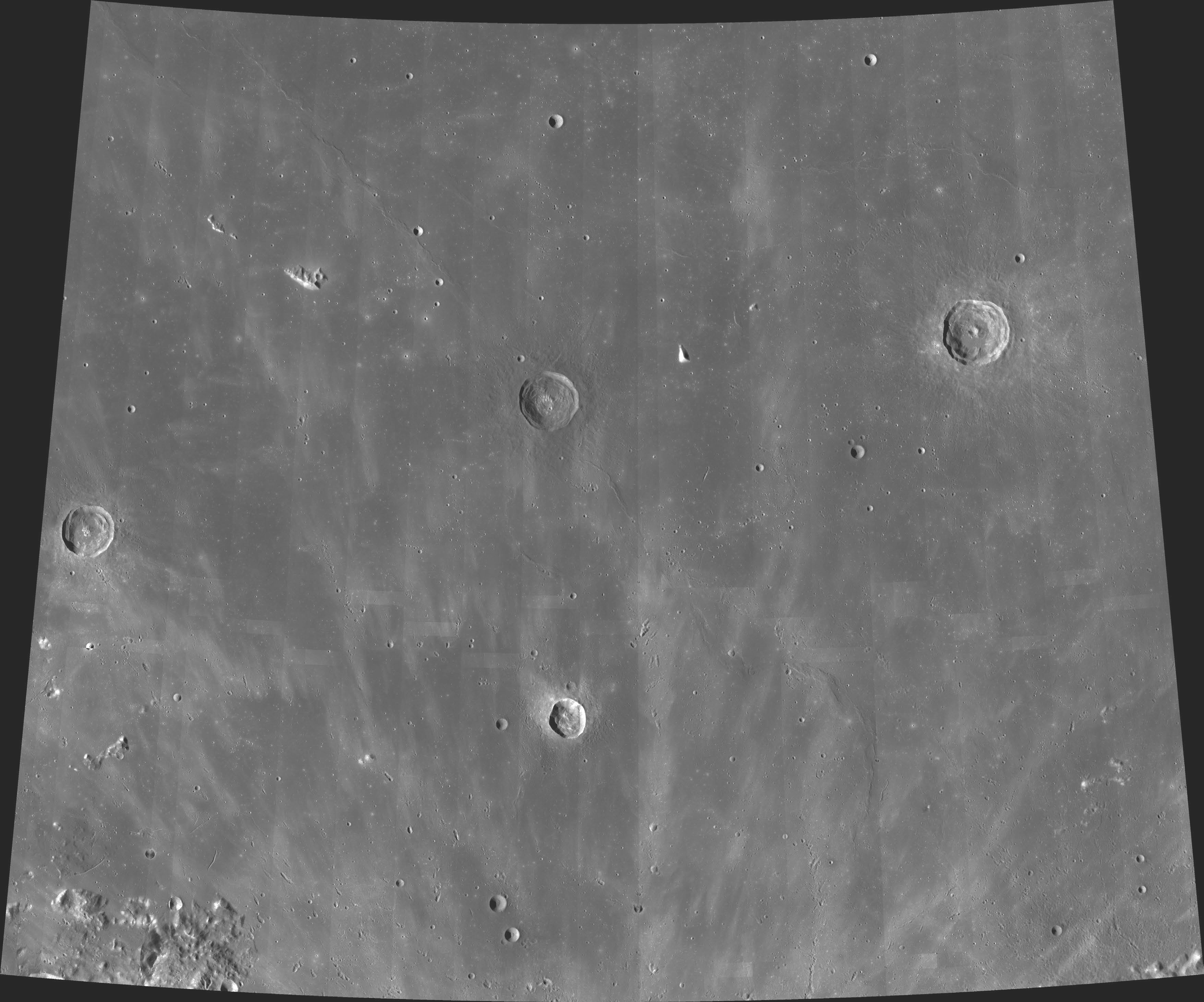
look a Lunar Orbiter image of the area.
 LO4-126-H3 Notice the object in the upper right.
Surprisingly, if this is all we had, I would have
been inclined to call this feature a a
v-shaped crater, except that the sun angle is wrong
and the optical illusion one gets is quickly dashed,
as the sun is coming from the rising sun in the
east, just like what we were imaging, and this is
indeed a small mountain.
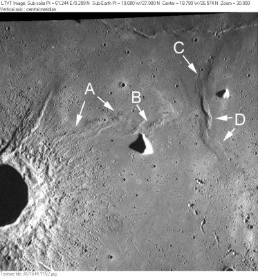
Here, then, is the ZOOMABLE unredated
version of Apollo Metric Camera image AS15-M-1152,
which also shows mountain #2:
This leaves us with a strong desire to know the
name and details of the size of this feature, which
eludes us at this point, as not even LAC (LRO) Wide
Angle Camera shot 40 titles it. The first link is
our hosted image, and the second link is the
original pdf file that can be enlarged to amazing
clarity.
Francis Ridge
Coordinator, The Lunascan Project IMPACT |