presents
COPERNICUS
Directory
- Section 31
|
|
presentsCOPERNICUS |
CRATERS IN THIS SECTION:
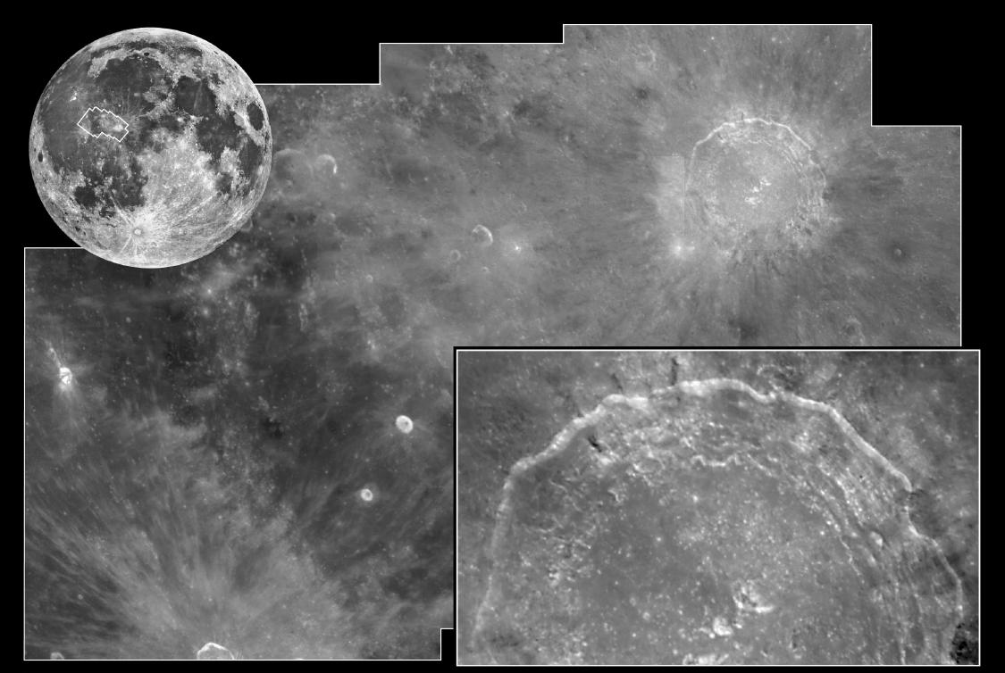
Copernicus (93 km)
Fauth (12.1 km)
Gay-Lussac (26 km)
Reinhold (48 km)
LUNAR ORBITER IMAGES:
Lunar & Planetary Institute:
http://www.lpi.usra.edu/resources/lunar_orbiter/
(Atlas)
http://www.lpi.usra.edu/resources/lunarorbiter/ (Photo Gallery)
http://www.lpi.usra.edu/search/?cx=002803415602668413512%3Acu4craz862y&cof=FORID%3A11&sa=Search&q=copernicus
(Compilation)
Copernicus
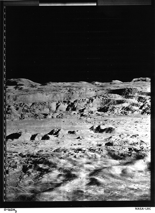
LO2-H162_3
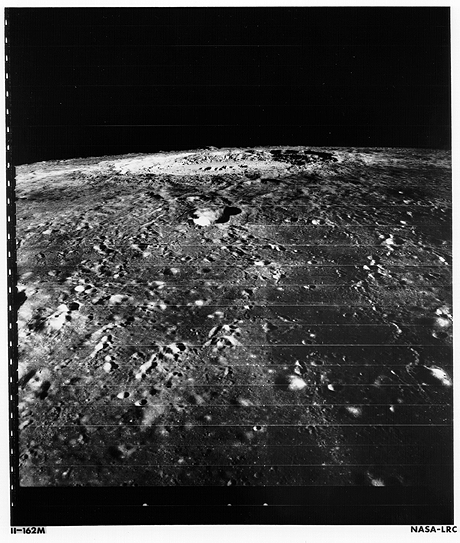
LO2-M162
LO4-121H2
LO4-121H2
/
4121 h2 raw (Lunar Orbiter Digitization Project)
LO4-126H2
LO5-151M
LO5-151M
/
5151 m (Lunar Orbiter Digitization Project)
LO5-152M
/
5152 m (Lunar Orbiter Digitization Project)
APOLLO IMAGES:
Landing
Sites Map
Copernicus
AS12-47-6875
AS12-47-6876
AS12-51-7541
AS12-52-7738
AS12-52-7739
AS12-52-7740
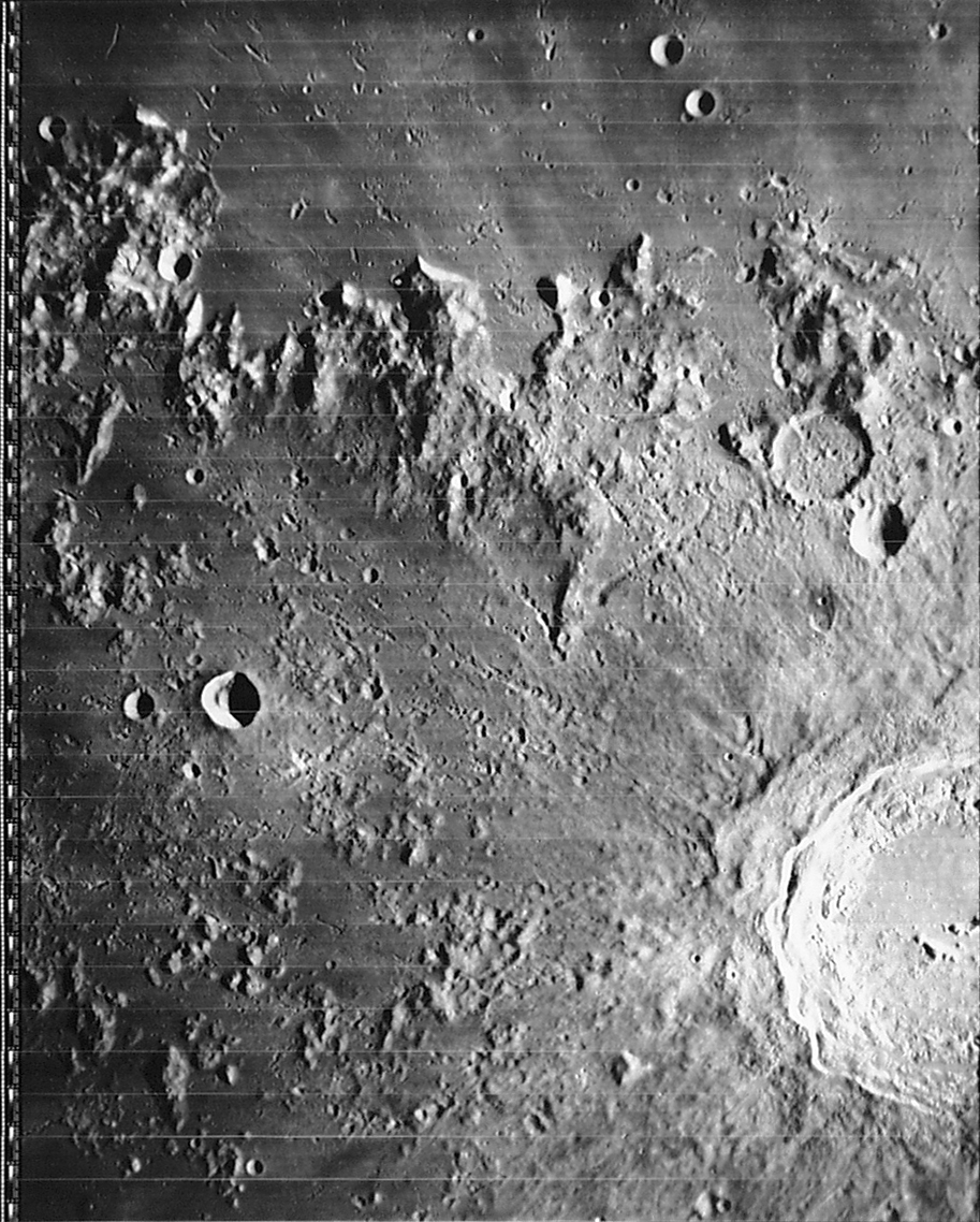
AS17-145-22285
AS17-145-22286
AS17-145-22287
AS17/151/23260.jpg
AS17-151-23260(H)
(1972 Image: Better than 1966 "Photo of the Century")
CLEMENTINE IMAGES:
clem2nd/slide_8
(LPI)
clem2nd/slide_9
(LPI)
scle_S09
(LPI)
HST IMAGES:
HST
Image
of Copernicus - April 1999
LRO IMAGES:
http://commons.wikimedia.org/wiki/Category:Photos_of_the_Moon_by_Lunar_Reconnaissance_Orbiter
LUNAR FLYOVERS:
http://www.youtube.com/watch?NR=1&v=OGZT9IanrRQ
http://www.youtube.com/watch?NR=1&v=VzF3JikY9KU
Kaguya Taking "Copernicus" by HD TV (HD)
RESEARCH UPDATES:
http://www.nasa.gov/mission_pages/LRO/multimedia/lroimages/lroc-20100930-copernicus-ejecta.html
http://www.nasa.gov/mission_pages/LRO/multimedia/lroimages/201000504-copernicus.html
http://www.lroc.asu.edu/news/index.php?/archives/616-Copernicus-Central-Peak-From-The-West.html
http://www.spaceref.com/news/viewsr.html?pid=40414
http://en.wikipedia.org/wiki/Copernicus_%28lunar_crater%29
Copernicus & the Canceled Apollo Mission
(The Lunascan Project, Fran Ridge)
The Boulders of Copernicus (Lunar Networks)
Lunar Geologic Mapping -
lpi.usra.edu/meetings/lpsc2005/pdf/2021.pdf
Copernicus
- Brief report from 50 Views (The Lunascan Project)
Copernicus
- An extensive report (Lunascan Project)
A Closer
Look At Copernicus (Lunascan)
Photo Of
The Century (Lunascan)
AS17-151-23260
- Oblique view shows Copernicus as being type example (SP-362)
AS17-2444(M)- Oblique view across M. Imbrium at Copernicus and
Pytheas (SP-362)
Copernicus
and
lo2_h162_123 (The Moon - Lunar Orbiter 2)
Copernicus
and
lo2 h162_3 (The Moon - Lunar Orbiter 2)
Copernicus
and
lo2_m162 (The Moon - Lunar Orbiter 2)
AS17-3067(P) - Rimmed depression north of Copernicus
(SP-362,228)
HST
Images The Moon - April 1999